I can look into it. I am also adding the shop data to other pages as well in table form.
- Adds Shop data to World/Item Details pages
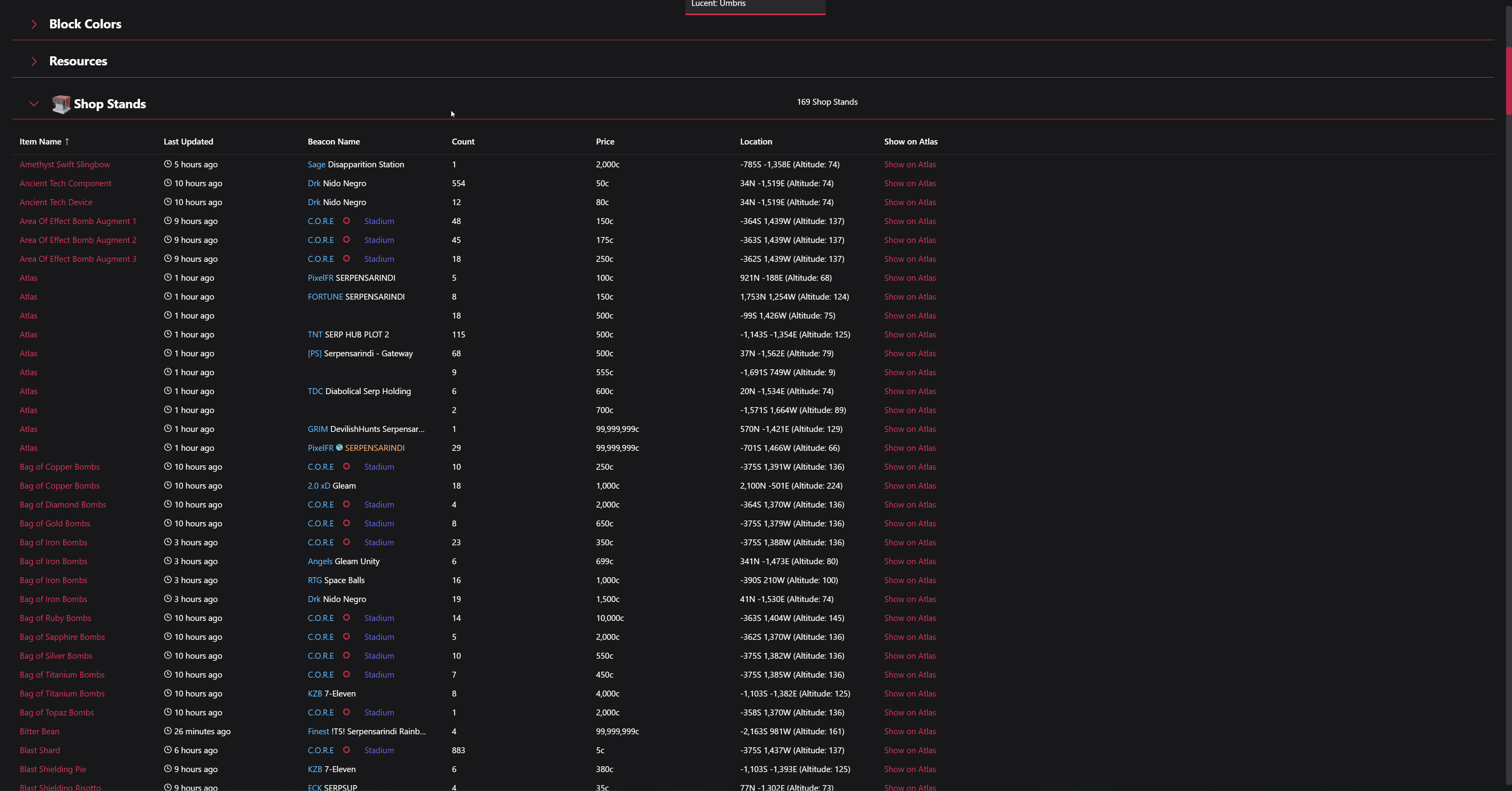

I looked into it, and as it currently stands, no I cannot add leaflet search. It looks like it both requires a backend to power the search and only searches on a single layer (shop stands and requests baskets are each their own layer).
The Boundlexx API does not support filtering/searching on Shops at the moment, you can either get all of the ones for a given world or all of the ones for a given item, not both. Also, for the searching on multiple layers, I would have to design a UI that allowed you to sensibly search on request baskets or shop stands.
I do plan to add more endpoints related to shop data in the future though, and I will definitely keep this in mind while adding new features to the backend. Hopefully adding shop data to the Item Details pages helps out though!
Also, something else that might be possible in the future is to also render the item being sold/bought inside of the shop stand/request basket as well. That should also help greatly with visibility on the map, at least for “browsing” a mall.
1 Like
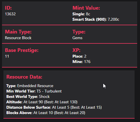
- Adds prestige, place/mine XP, type data and resource data to Item Details.
- Adds a Help Link that goes back to this forum thread.
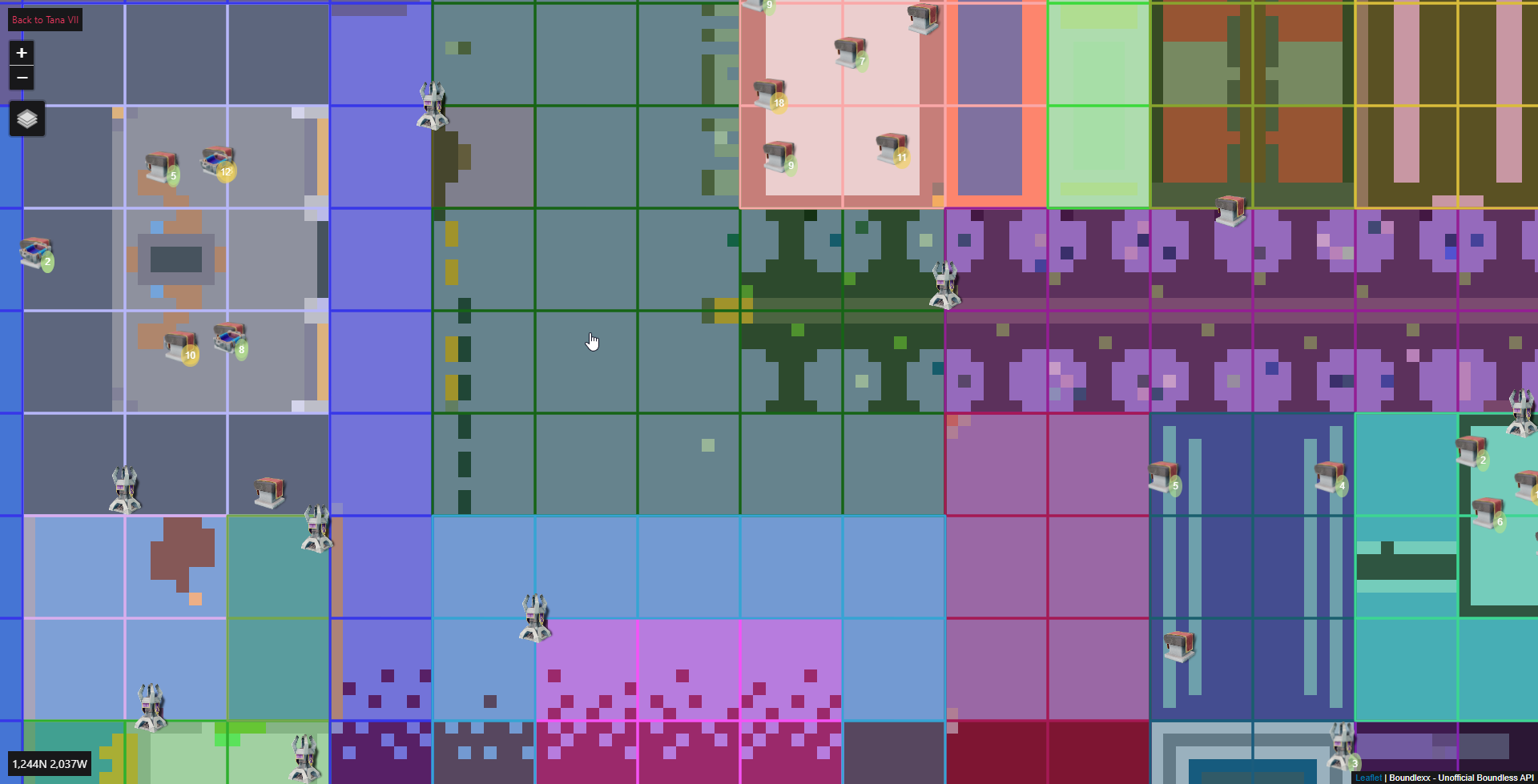
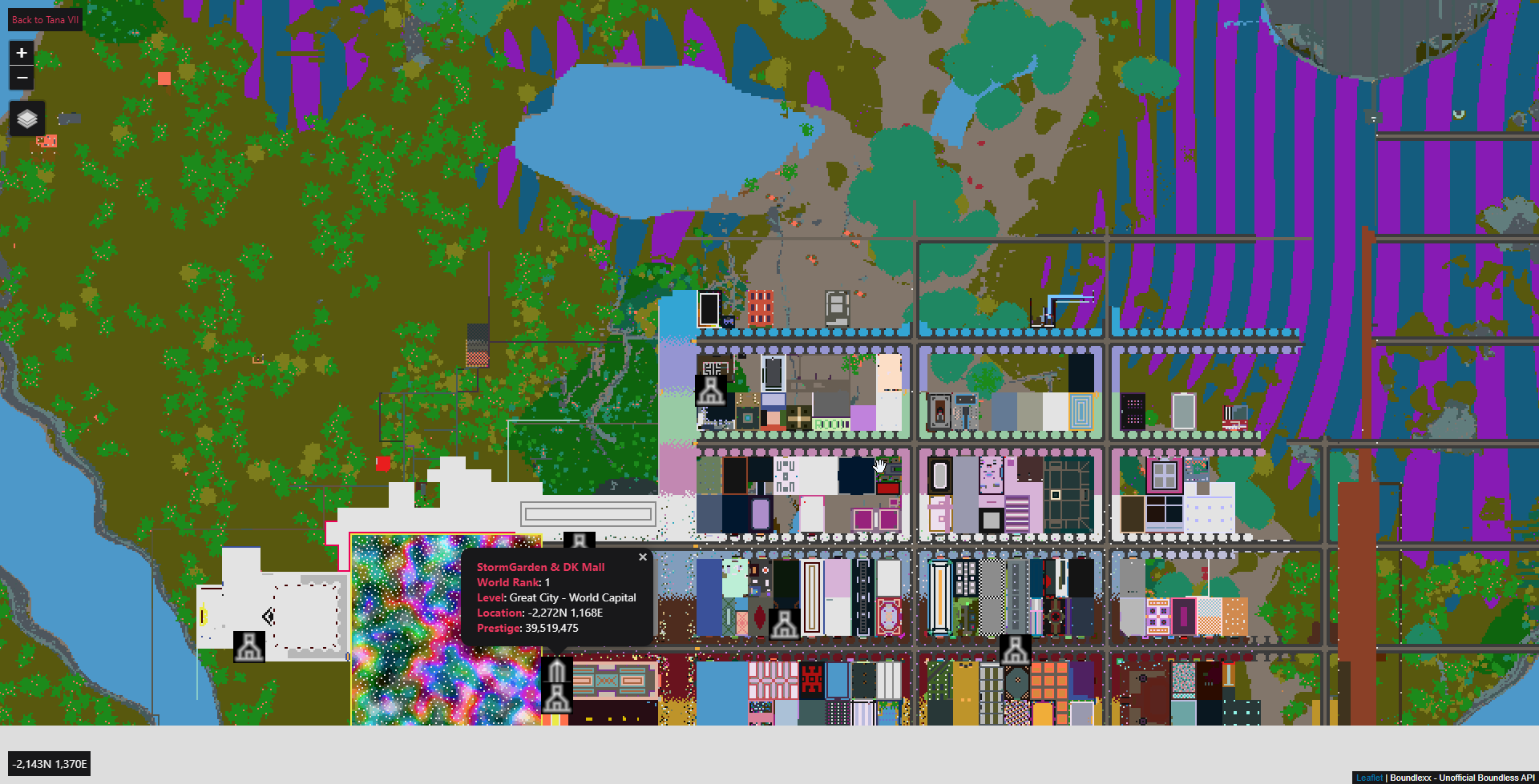
- Adds Beacons to Atlas Map.
- WARNING: Beacon Boundaries exist as well in a separate layer, but they are disabled by default until I have improve the rendering performance. You can enable them in the layers control on the left. Use at your own risk as they may freeze/crash your browser.
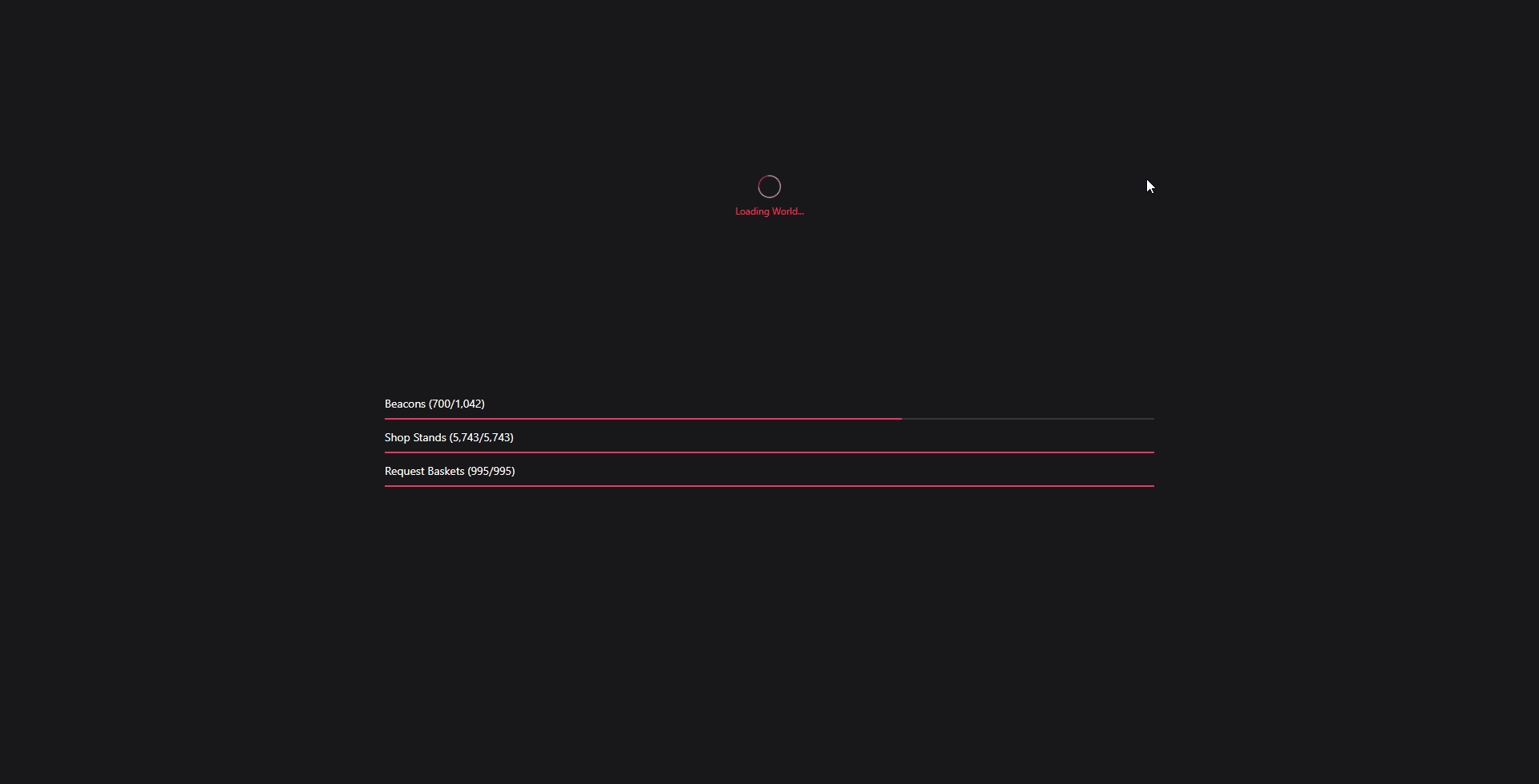
- Adds loading progress bars to the Atlas Map.
If you are having trouble seeing the beacons: If worlds are loading zero beacons, you may need to clear your cache/site data for the Website. There was some pretty hardcore caching on API definition file that has since been removed, but you may need to clear the cache to get the new API definition file. Otherwise Beacons will never load.
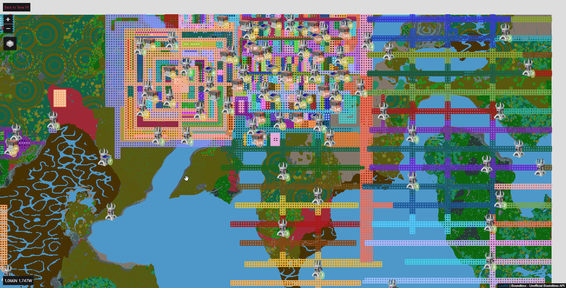
- Fixes the performance issue with Beacon Boundaries and now they are enabled by default. At lower zoom levels, boundaries are merged into a single polygon rendered together. As you zoom in, it will show the individual plot boundaries for that beacon.

5 Likes

I’m loving this.
1 Like
Chapeau Sir,
… You are doing a great job with this tool.
Thanks, and
… keep on ![]() developing it
developing it ![]()
![]()
![]()
nice work
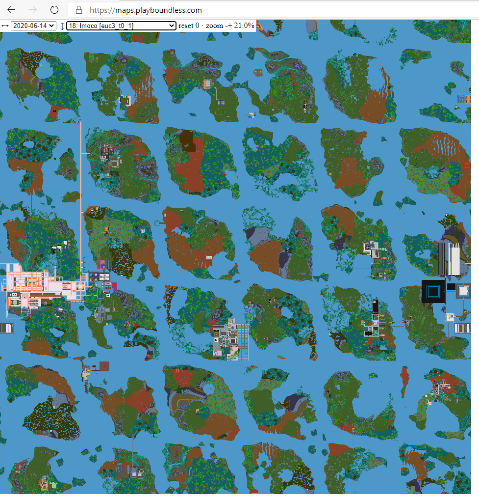
just 1 question, can you set up a zoom level that it is possible to see the complete world ? or maybe a bit more ?
at the moment you can zoom from 0 (max zoom out) till 5 (max zoom in)
can you maybe set a -3 level ??
1 Like
I have been wondering that, and I am think it is because the world atlas image is relatively “low” resolution (it is like only 4800x4800 or something kind of low). I know there is a way in Leaflet to customize zooming, but I have not dug in enough to figure out how. It might also be related to the fact the main world image does not tile and the map has locked max bounds as well.
zoom out not in
i will see the complete world on 1 screen
That is the problem, you are zoomed out as far as you can. Leaflet’s zoom levels are 0-15. Zero is the maximum “zoomed out”. I have capped zooming in at 5 because beyond that is just crazy. I think the map engine is doing something to limit that. I have not figured out how to customize the zooming yet (I am pretty sure it can be done, just have to actually dig into the docs/code to figure out how).
should it normal not be easier to see the image in a complete instead, zoomed in ? ^^
here the view i would like on your page ![]()
maybe i can look tomorrow how the config works
but zoom 0-5 works without any problem on my pc with active beacons and shops, good job
1 Like
@Angellus some days ago you say i should help if i can, here we go
I save you the time for searching it ![]()
set the line 3075 to 0.1 or 0.25
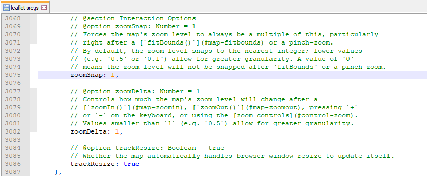
here the part from the docs

here the link to the docs
https://leafletjs.com/examples/zoom-levels/
so yes its real simple to config
1 Like
That does not change the initial zoom scale. Fractional zooming only lets you change how much you zoom in, not at where you zoom starts at. How much you zoom is tied to the scale of the map, so you have to add a completely new scale factor to the map.
If you want to help the project that is great, but please keep it off the forums. Go make a Github issue (or even better yet, go make a PR). This thread is not designed to debate/discuss features (it is only single “thread” and hard to have discussions in).
1 Like
- Adds categories to Emojis
- Adds local filtering for simple filters
- Changes all tools pages into a single header
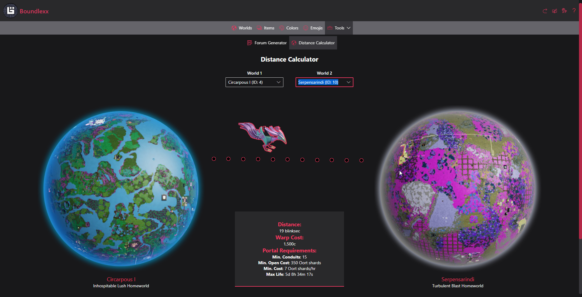
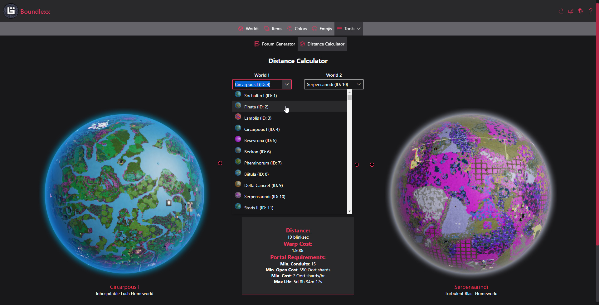
- Adds World Distance Calculator
- Improves World Selector performance/styling/limits on number of Worlds
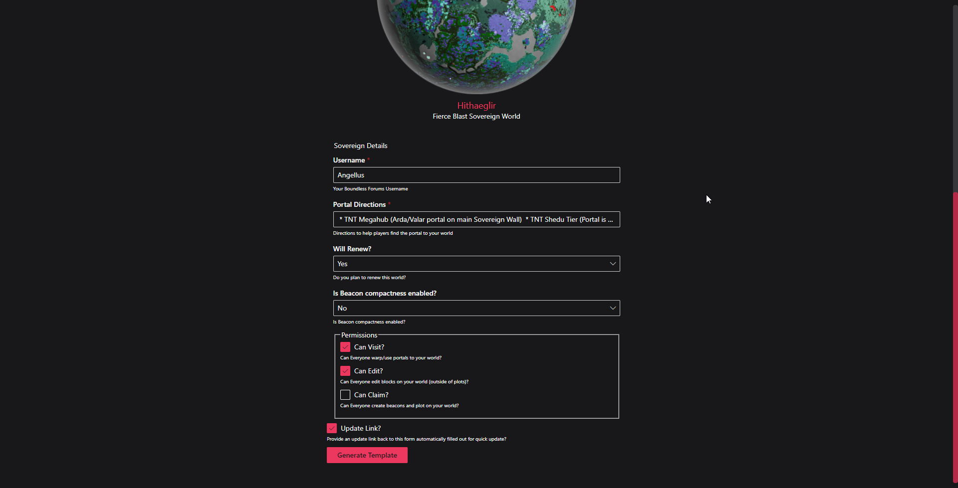
- Adds world image to Forum Template Generator
- Changes Forum Template Generator to persist state in URL like other pages
- Add negative zoom levels to Atlas Map so you can see a whole world at once.
- Apparently Leaflet does support negative zoom levels. It was just not in the main docs… I found it in a random example.
- Fixes displaying game coords
- Adds settlements to Atlas Map (better marker images planned)
- Adds world images and html names to World Selector
2 Likes
- Adds a ton of links to other awesome community tools.
If your tool is marked as “NOT SECURE” it is because of one of the following:
- You are not using HTTPS
- You do not support TLS 1.2 or TLS 1.3

2 Likes
Wrong color here


I am not able to reproduce nor does it look like the backend data has ever had those values for those worlds (color data comes directly from the game).
If you are able to reproduce, can you please provide a video of it happening? Or detailed reproduction steps including browser and OS with versions.
1 Like
just tryed seaching for them once more and they are not there anymore. no ide what happend before
Boundlexx UI will not be functional for a few hours next Tuesday due to a planned maintenance for the Boundlexx API.